The integration of UK Sites of Special Scientific Interest (SSSI) into our flight planning platforms is an exciting development for drone operators. This integration, driven by valuable feedback and requests from the drone community, aims to enhance your drone flight planning by providing more information to ensure responsible and respectful flights in the UK.
UK Sites of Special Scientific Interest (SSSI) are designated areas recognised for their outstanding ecological importance. These sites, carefully selected by Natural England, Natural Resources Wales, and Scottish Natural Heritage, showcase diverse landscapes, rare species, and culturally significant landmarks. They serve as vital ecosystems and play a crucial role in preserving our natural heritage.
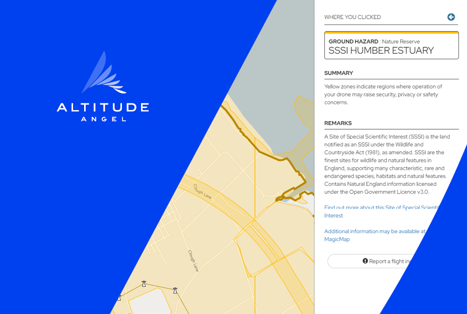
With the integration of UK SSSI sites into our flight planning platforms, drone operators will find the sites under ‘Ground hazards’, visible by zooming in during the flight planning process within Drone Assist, Dronesafetymap.com and partner solutions. This will display SSSI sites in the area, giving drone operators visibility of these sites prior to their flights.
By having visibility of SSSI sites during the flight planning stage, drone operators can proactively plan their flights in a way that minimises potential disturbances and prioritises the preservation of any ecologically sensitive area. It empowers drone operators to make informed decisions.
UPDATE 10 July 2023:
SSSI sites in England, Scotland, and Northern Ireland will all feature a direct link for these regions, leading drone operators to the specific detail page for each site of interest. Please keep in mind that the user experience may vary, as the devolved nations have their own separate websites.
While it is not as straightforward for SSSI sites in Wales, we have included the necessary link to the Natural Resources Wales website where you can access the relevant information.
From within the App you will also be able to refer to DEFRA's 'Magic map', a comprehensive map covering a wide range of environments, including rural, urban, coastal, and marine areas across Great Britain.