Welcome to our API suite
Designed for software developers and drone manufacturers, our API's deliver a range of services to enhance your applications and elevate your product and business capabilities.
-
Start your journey with a 30 day free API trial here
-
Already have an account? Log-in here
-
For questions about features or pricing, please contact our Sales team

Feature information:
Surveillance
Aware | Prepare | Fly
Send aircraft surveillance data directly to our GuardianUTM system from sensor devices and access a wide-range of UTM services.

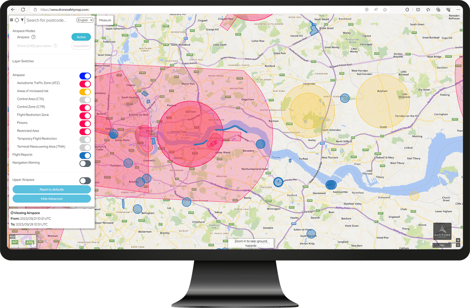
Ground Hazards
Prepare | Fly
Configurable data from over 80 categories of ground-based hazards including schools, prisons, power pylons and cable cars.

Airspace Data
Prepare | Fly
Configurable, global, airspace navigation data from over 100 categories of permanent and temporary airspace classifications and warnings. Includes crewed (Aeronautical Information Publications) and uncrewed (e.g. European U-space and FAA UAS) datasets.

Approval Services
Prepare | Fly
Allows the creation of drone flight plans and streamlined digital approvals within zones set up on Altitude Angel’s GuardianUTM.

Airspace Alerts
Prepare | Fly
Receive real-time alerts when potential conflicts with aircraft are detected.

Area Reports
Fly
Receive a summarised report of hazards, including an overall severity assessment, within a given area.

Strategic CRS
Fly
Identify conflicting flight plans across your own submitted operations, or across all flight plans submitted through Altitude Angel’s global network.

Weather
Fly
Receive a summary of the latest observed atmospheric conditions and the one hour forecast for a specified area, including wind direction and speed, humidity and cloud cover.

Space Weather
Fly
Receive the latest reported KP-Index for the disturbance to Earth’s magnetic field caused by solar winds.


GuardianUTM Cloud API users include:


Find out more about our GuardianUTM Cloud platform